NASA's Terra and Aqua satellites captured hail scar facilitated by recent storm in Alberta
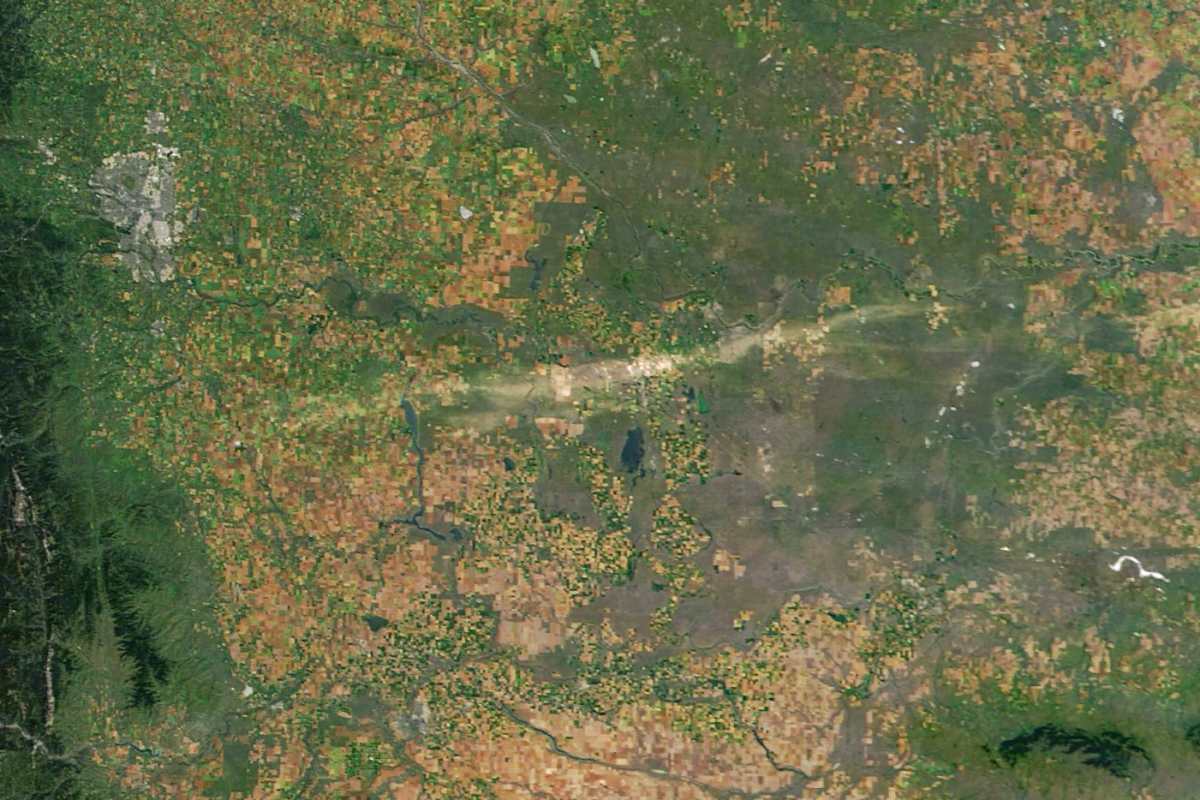
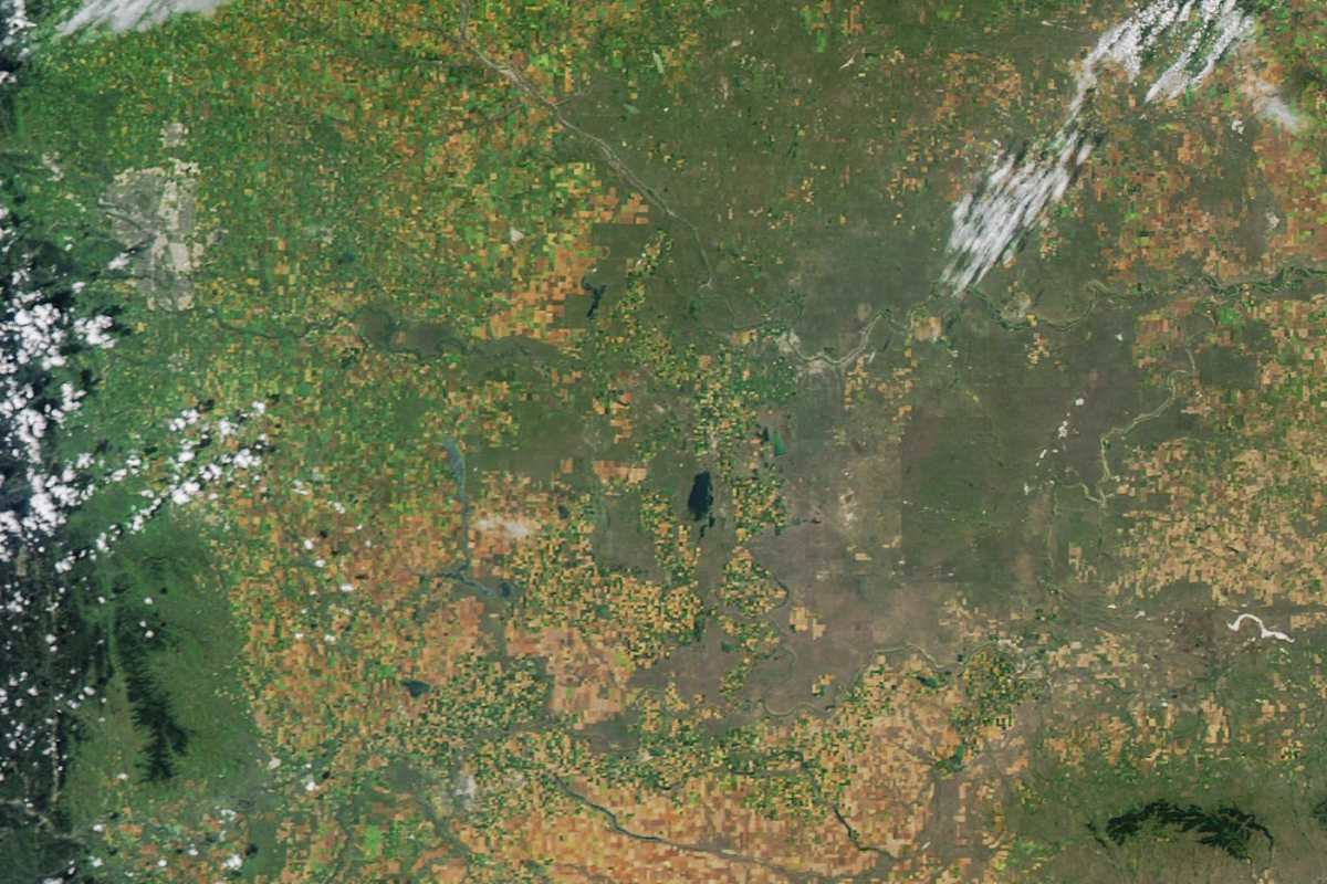
A pair of satellites has captured some uncanny pictures of a hail scar from southern Alberta, Canada. These satellites are NASA's Terra and Aqua satellites, both of which have used the MODIS (Moderate Resolution Imaging Spectroradiometer) for the pursuit. This scar is a consequence of a storm that hit the area on August 20, 2025, according to NASA Earth Observatory. Two images captured by the satellites reveal the damage inflicted by this fairly strong storm. Some observers claimed that the hail ballooned to the size of a golf ball. Both images, taken some days apart in the same area, show the change that occurs due to a natural phenomenon, like a storm.
Hailstorm Attacking Alberta
It is not the first time a storm has hit southern Alberta, as the region is known to be a hotspot of such events. The frequency of storms in these regions is so high that the place has been nicknamed "hailstorm alley." The area's climate, as well as geography, encourages the formation of storms. Hence, the region experiences dozens of hail events each year, leading to hundreds of millions of dollars in damage. The storm captured by the satellites has been categorized as a supercell storm by experts. This storm carried winds that were pacing at the speed of 93 miles per hour.
Images Captured by the Satellites
The images reveal the extent of damage inflicted by the storm. The first image was taken by Terra on August 19, 2025 (before the storm), and the second one was taken by Aqua on August 24 (after the storm). Satellites can capture such storms from space, especially between mid- to late summer, as vegetation turns green due to maturing. The first image showcases an expanse containing forests, grasslands, and farmland in the southeast of Calgary. All these landforms were represented by green, which in the second image gets distributed haphazardly. This pattern expresses that the storm had battered the region.
There is also a clear hail scar in the latter image represented by a cloudy vertical feature, which experts claim was nine miles wide and 124 miles long. The storm has caused heavy damage to the region, according to the reports. Insurers are expecting hefty claims in the coming days from several victims. It will add to the insured losses of 92 million Canadian dollars ($66 million) that the companies had to undertake due to a July 2025 storm. In the last five years, more than six billion Canadian dollars ($4.35 billion) have been spent on insured hail damage by the companies, according to Insurance Business.
Use of these Images
Weather scientists believe that input from such images could aid in improving hail risk models, which would help authorities prepare for such incidents more efficiently. In this pursuit, scientists from NASA's Langley Research Center have already collaborated with several reinsurance companies. "With state-of-the-art identification techniques, we can quantify severe storm distribution and frequency with an exceptional level of consistency and persistence that's only granted by satellite measurements," shared Benjamin Scarino, a research scientist at Langley, according to WTW. "Long-term satellite data records allow us to provide the reinsurance industry, project partners, and the research community with valuable insights into severe storm activity and risk."